Welcome to the Dún Laoghaire-Rathdown County Council County Development Plan, 2022-2028 webpage.
Dún Laoghaire-Rathdown County Development Plan 2022-2028
The Dún Laoghaire-Rathdown County Development Plan sets out the policies and objectives for the development of the County over the Plan period.
The County Development Plan 2022-2028 came into effect on the 21st April 2022.
The Dún Laoghaire Rathdown County Development Plan 2022-2028 is available to view below together with all documentation produced throughout the Plan Making process.
Hardcopies are available to view at the following locations:
- Planning Department, County Hall, Marine Road, Dún Laoghaire, Co. Dublin Mon-Fri (excluding Bank Holidays) between 10.00a.m and 4.00p.m and
- Council Offices, Dundrum Office Park Main Street, Dundrum, Dublin 14 Mon-Fri (excluding Bank Holidays) from 9.30a.m to 12.30p.m and 1.30p.m to 4.30p.m
Note: The adopted development plan documents and maps have been amended in order to apply the requirements of the Ministerial Direction and subsequent Judicial Review.
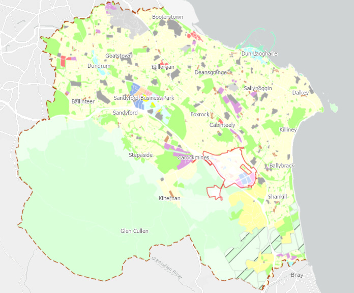
Click on the map to access our County Development Plan Interactive Webmap:
Ministerial Direction
The Minister of State at the Department of the Housing, Local Government and Heritage, consequent to a recommendation made to him by the Office of the Planning Regulator under section 31AN(4) of the Planning and Development Act 2000 (as amended), issued Dún Laoghaire-Rathdown County Council a Direction to the Dún Laoghaire-Rathdown County Development Plan 2022-2028 on the 28th September 2022.
In accordance with Section 31 of the Planning and Development Act 2000, those parts of the Dún Laoghaire-Rathdown County Development Plan 2022 – 2028 referred to in the notice, have not come into effect and have been removed from the adopted Development Plan, namely:
- The second paragraph of Section 12.3.3 ‘Quantitative Standards for All Residential Development’ of Chapter 12 (pg. 236) of the Written Statement, which states: “That the requirement for certain percentages of 3-bed units in apartments shall apply to Build To Rent developments to accord with mix on page 237.”
Judgement in respect of a Ministerial Direction - 0/0 Objective
The Ministerial Direction received in September 2022 also included the omission of the 0/0 Objectives from Chapters 4 and 12, and, Maps 3, 4, 7 and 10 of the Development Plan.
The omission of the 0/0 Objectives set out in the Ministerial Direction was Judicially Reviewed.
The final judgement of this case was delivered on 12th March 2026 (refer Court of Appeal No. 2025/86, 2025/87) resulting in the reinstatement of the 0/0 Objective as set out in the adopted Dún Laoghaire-Rathdown County Development Plan 2022 – 2028. In this regard, sections that were removed with regard to the 0/0 objective are now in effect and are available to view below; this includes:
- Reinstatement of the 0/0 objective including the symbol and boundary of its objective area* on Land Use Zoning Maps 3, 4, 7 and 10.
- Reinstatement of the text “No increase in the number of buildings permissible” in the legend of Land Use Zoning Maps 1-14.
- Reinstatement of policy text headed ‘Notable Character Area Exclusions’ at the end of section 4.3.1.1, Policy Objective PHP18: Residential Density in Chapter 4 of the Written Statement (this section has been added online as an addendum to Chapter 4).
- Reinstatement of a ‘0/0 Zone’ Section (Section 12.3.7.12) in Chapter 12 of the Written Statement (Section 12.3.7.12 has been added online as an addendum to Chapter 12).
For clarity - an objective area boundary is retained on Land Use Zoning Maps 3, 4, 7 and 10 for Specific Local Objective (SLO)130. The 0/0 objective boundary aligns with the Objective boundary for SLO 130. All relevant maps have been updated as required.
Monitoring
The Annual Monitoring Report analyses progress made in the first year since the DLR County Development Plan 2022-2028 came into effect on the 21st April 2022.
The annual report has been prepared having regard to the Section 28 ‘Development Plan Guidelines for Planning Authorities’ (2022). The Guidelines state that it is a policy and objective that an ‘Annual Development Plan Monitoring Report’ is assembled by the Planning Authority and made available to the Elected Members and thereafter published on the website of the Planning Authority.
Record of Protected Structures
The Record of Protected Structures (RPS) as set out in Appendix 4 and structures that are shown on maps, are those that existed on the 10th April 2022 when the County Development Plan 2022-2028 was made. It should be noted that additions and deletions to the Record of Protected Structures may be made on an ongoing basis and amendments to the Record can be viewed on our RPS webpage:
My Plan
Myplan.ie is an initiative of the Department of the Environment, Community and Local Government on behalf of all of the planning authorities across the country.
The aim of Myplan.ie is to create a one stop shop for information about plans and also to provide other information which is relevant to planning decision-making (census, heritage sites, patterns of housing development etc) that will not only be of benefit to citizens but will also assist with coordination between local authorities and more generally with the delivery of public services.
County Development Plan 2022-2028
Monitoring
Stages involved in the preparation of the County Development Plan 2022-2028
FAQ
What is a Development Plan?
In simple terms, a Development Plan is a spatial plan that guides the future development of a County for a six-year period through a suite of policy objectives, land use zoning objectives and development management guidance.
A Development Plan must ensure that there is enough land zoned in the County to meet our housing requirements which are set at a regional level. Chapter 1 of the Plan sets out more detail in relation to the legislative context and structure of the Development Plan.
A short video was prepared at the Draft Plan stage which provides an overview of what a Development Plan is and the vision for the County for the period 2022-2028 (note: the Draft Plan consultation ended in April 2021 - submissions can no longer be accepted).
Section 10 of the Planning and Development Act, 2000 (as amended) sets out the statutory content of a Development Plan – these requirements are summarised in Appendix A of the pre-draft ‘Have Your Say’ document.
When did the new Development Plan come into force?
The County Development Plan 2022-2028 was made / adopted, with amendments, by the elected members during Special County Development Plan meetings on the 9th and 10th March 2022.
Section (12) (17) of the Planning and Development Act, 2000 (as amended), states:
"A development plan made under this section shall have effect 6 weeks from the day that it is made."
The new plan came into force on the 21st April 2022.
When will planning applications be assessed under the new Plan?
Proposed development (planning applications) will be assessed upon the provisions of the development plan in force at the time of making a decision in accordance with Section 34(2)(a) of the Planning and Development Act 2000 (as amended), which states:
“(2) (a) When making its decision in relation to an application under this section,
the planning authority shall be restricted to considering the proper planning
and sustainable development of the area, regard being had to—
(i) the provisions of the development plan, …”
The Plan came into force on 21st April 2022 therefore all decisions are now being assessed having regard to the policy objectives of the new plan.
Can I download documents?
Yes – all Development Plan documents are provided on our webpage as downloadable PDFs.
Each Volume of the Chief Executive’s Report is provided on our webpage as a downloadable PDF.
Note: The Ministerial Direction effects certain parts of the adopted Plan that is currently available to download. The Planning Authority are updating all relevant sections which will be available to download in due course.
Can I get a hard copy of the Plan?
The Dún Laoghaire Rathdown County Development Plan 2022-2028 is available to view above. Hardcopies are available to view at Planning Department, County Hall, Marine Road, Dún Laoghaire, Co. Dublin Mon-Fri (excluding Bank Holidays) between 10.00a.m. and 4.00p.m. and at the Council Offices, Dundrum Office Park Main Street, Dundrum, Dublin 14 Mon-Fri (excluding Bank Holidays) from 9.30a.m. to 12.30p.m. and 1.30p.m. to 4.30p.m.
Hardcopies of the Plan will not be available to purchase until after the process of updating plan documents and maps, to incorpoarte the requirements of the Ministerial Direction, is complete.
Will the Development Plan tell me what is happening in my area?
A Development Plan sets out the land use zoning objectives for an area.
The land use zoning objectives for the County are set out over a series of 14 maps and an interactive webmap.
Certain uses which may be permitted in principle or open for consideration within each land use zone is set out Chapter 13 of the Development Plan.
Proposed development within an area occurs when a developer (public or private), or an individual, proposes and obtains the relevant planning permission. This ‘development management’ process is separate to the Development Plan making process. Proposed development is required to accord with the provisions of a Development Plan.
I’m not sure which map is relevant to my area, is there another way to find out what land use objectives are relevant to me?
Yes – our interactive map has an address search function. To zoom into your desired location, simply enter your address or Eircode, in the ‘find’ bar located at top left of the map.
If you want to download the map relevant to your area, the easiest way to find the correct map is to visit the map area in our virtual room where a map index shows all map numbers and the areas they cover.
The interactive map isn’t working properly – what can I do?
The interactive map may not function properly for a number of reasons, often a simple refresh of the page will reload it without issue. Some other suggestions that may remedy your issue include:
• The interactive map works best and should be opened on one of the following web browsers: Chrome, Firefox, Safari or Edge.
• Please ensure that you have accepted the terms and conditions by ticking the box upon opening the map.
• Some layers will not load until you zoom into an area.
• The mapping service provider esri may be carrying out essential updates – this is usually a very limited time only and the map may load successfully again in 10-15 minutes time.
Land use mapping for the entire county is available to download as separate PDF documents from our webpage.
In the event that you continue to have difficulty accessing the interactive map, please contact us planning@dlrcoco.ie with details of the issue.
Can I still view the Draft Plan, Amendments to the Draft Plan and Chief Executive's Reports?
All plan documents and Chief Executive's Reports associared with each stage involved in the preparation of the County Development Plan 2022-2028 is set out above.
The Draft Plan can also still be viewed within the virtual room that was prepared for its consulation phase.
How do I find the response to my submission in the Chief Executive’s Report?
In order to navigate the Chief Executive’s Report, it is recommended that you first open Volume II to locate your submission number (B0001-B1263). This can be done by searching for your name or organisation using ‘Ctrl’ & ‘F’ on your keyboard, or by using the search function in your PDF software.
All submissions are summarised in Volume II and submission numbers are hyperlinked to view the submission, including any attachments, as received by the Planning Authority (Note: some details may have been redacted before publishing online).
Under each submission summary, the location of where the issues raised are located in Volume I is stated, i.e. Chapters 1-15, Appendix 1-17, Land Use Mapping, Miscellaneous, or, it may state that no issue was raised.
Issues raised are summarised and the Chief Executive’s response and recommendations are set out in Volume I under the relevant Chapter heading of the Draft Plan. Where more than one submission / observation raised the same issue, these are grouped together, and all submission numbers are listed along side the summary of the issue.
The quickest way to find where your issue is located in Volume I, search using your submission number using ‘Ctrl’ & ‘F’ on your keyboard, or by using the search function in your PDF software.
Why have I received a letter / more than one letter?
All owners and occupiers of properties or structures added to or deleted from the Record of Protected Structures (RPS) in the adopted Plan are legally required to be notified as per Section 12(13) of the Planning and Development Act (as amended).
The requirements of Section 12(13) of the Act may result in you receiving two letters if the owner is also occupier the structure added or deleted from the RPS.
The Record of Protected Structures is set out in Appendix 4 of the Development Plan and are shown in a dark yellow colour on land use zoning maps.
I have received a letter in error – who should I contact?
If you have received a letter in relation to the addition of property / structure to the Record of Protected Structures in error, please advise the Planning Department as soon as possible using the contact details at the top of the letter.
Why was my property added to the Record of Protected Structures (RPS)?
Your property / structure was been recommended for inclusion onto the Record of Protected Structures “in order to protect a structure, or part of a structure, of special architectural, historical, archaeological, artistic, cultural, scientific, social or technical interest” (Section 54 of the Planning and Development Act, 2000, as amended).
A notice was issued to owners/occupiers of properties/structures recommended to be added to the RPS at Draft Plan stage. The notice issued states whether the recommendation was made by the Minister for Housing, Local Government and Heritage or by the Planning Authority.
Properties / structures recommended for addition by the Minister resulted from surveys carried out for part of the County. More specific details for a particular structure can be found in the surveys of the National Inventory of Architectural Heritage: here.
Properties / structures recommended for addition by the Planning Authority were as a result of either - submissions received at pre-draft stage (see pre-draft CE Report for details), Motions from Elected Members (see Special Meetings from December 15-18th 2020), the property / structure was brought to our attention during the preparation of the current County Development Plan 2016-2022 or when dealing with planning applications since the adoption of the current Plan.
Further details with regard to Protected Structures can be found here on the Conservation section of our website.
Why was my property not added to the RPS previously?
The surveys carried out by the Minister for Housing, Local Government and Heritage for part of the County were not fully completed prior to the adoption of the current County Development Plan 2016-2022.
What is an Architectural Conservation Area (ACA) and where can I find more details on new ACA's?
An Architectural Conservation Area (ACA) is a place, area, group of structures or townscape that is of special architectural, historical, archaeological, technical, social, cultural, or scientific, interest, or that contributes to the appreciation of a Protected Structure. An ACA aims to identify and protect areas of special significance and promote an awareness of this significance.
All ACA's are listed in Appendix 4 of the Development Plan with links to each of their Character Appraisal documents.
Further details with regard to ACA’s in general can be found here on the Conservation section of our website.
My property appears to be within a flood zone – why is this?
Flood Zone Maps are maps of areas predicted to be at risk of flooding in the 1.0% annual exceedance probability (AEP) event (1 in 100 year - Flood Zone A) and the 0.1% AEP event (1 in 1000 year - Flood Zone B).
The Flood Zone Maps were produced as an output of the Eastern Catchment Flood Risk Assessment & Management (ECFRAMs) project (2010 -2017) and were subject to statutory consultation and approval during that period.
For specific flood risk considerations of an area, please Appendix 15 Strategic Flood Risk Assessment of the Development Plan.
If my query isn’t listed here, who should I contact?
In the event that your query has not been covered here, please contact E: planning@dlrcoco.ie / T: 01 2054700.
Disclaimer
The list of FAQs do not purport to be a legal interpretation of the Planning and Development Act 2000 (as amended) and are simply for information purposes.
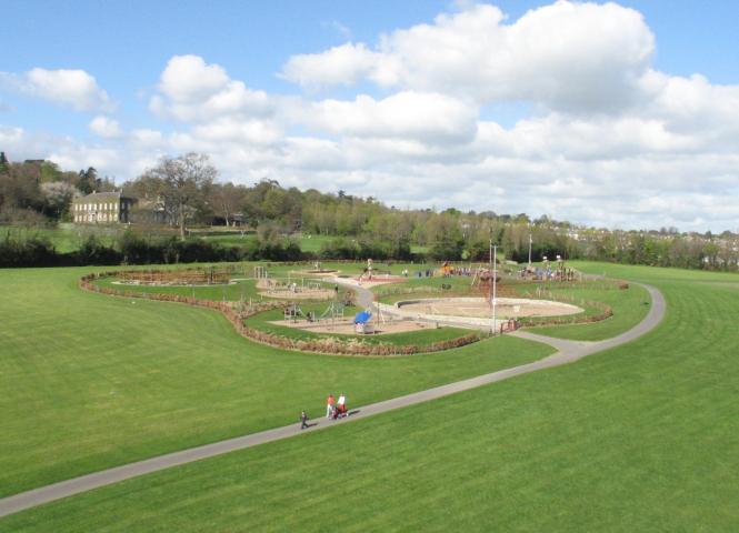
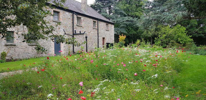
Gallery