Cherrywood SDZ
Cherrywood SDZ Planning Scheme
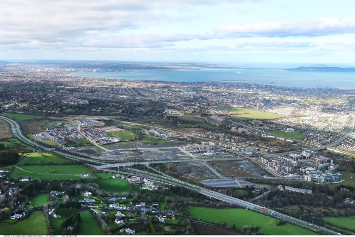
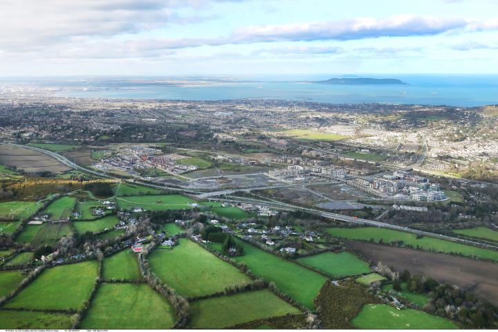
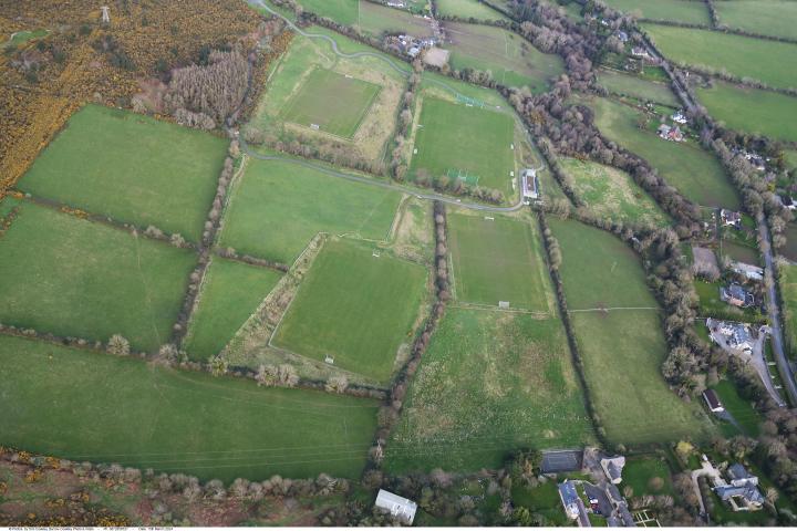
Cherrywood SDZ is the single largest undeveloped land-bank in Dún Laoghaire-Rathdown, and is approximately 360 hectares in size, nestled at the foot of the Dublin Mountains, is strategically located between the M50 and N11 transport corridors approximately 1km north of where they fork from the M11 and approximately 8km south of Dún Laoghaire town centre. Dún Laoghaire-Rathdown County Council, in recognising the area's strategic importance, applied to the Government for Strategic Development Zone (SDZ) status and the Government designated it as an SDZ in May, 2010.
Important Note
The Cherrywood Planning Scheme document list below under "Main Document" has been updated to incorporate recently approved Amendments to the Scheme i.e. Amendment 6 in respect of Residential Car Parking Standards (Section 4.2.10 of the Approved Scheme 2018), approved in January 2020 by An Bord Pleanála, Amendment 7 Beckett Road Realignment, approved in April 2021 and Amendment 8 Building Height & Density Review which was approved in July 2023. The Approved Amendments for this can be accessed here or by clicking on the Approved Amendments to Cherrywood Planning Scheme tab below.
Please Note
Please note the approved Cherrywood Planning Scheme document, (as amended), will be updated following determination on Proposed Amendment No. 11, to incorporate the latest approved text and a revised document will be made in available in due course both on the web and in and copy format. However, in the interim, the Scheme must be read in conjunction with the relevant recently Approved Amendment No. 9 Residential Car Parking text documents, which can be accessed through the links above or via the Related Documents link below.
Dún Laoghaire-Rathdown, in their role as the designated Development Agency for Cherrywood SDZ, had a statutory duty to draft and agree a Planning Scheme for the SDZ, which was approved by Council following a comprehensive public consultation in December 2012. This was then formally submitted to An Bord Pleanála who subsequently approved the Planning Scheme with modifications in April 2014.
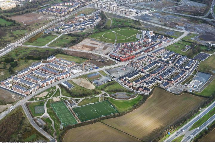
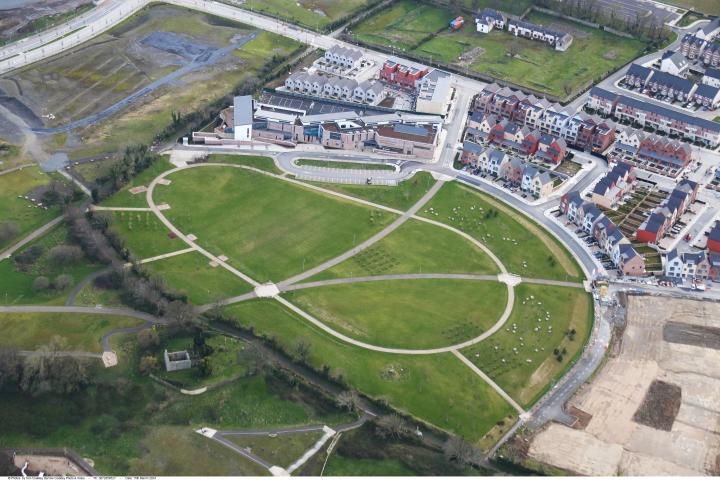
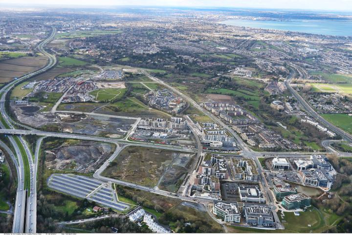
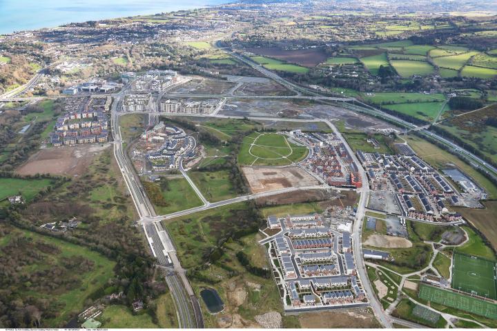
The front-loading of significant transport and social infrastructure (parks and schools) outlined in the approved Cherrywood Planning Scheme 2014 (as amended) will ensure that the SDZ area will be transformed into a new vibrant community, with approx. 10,500 homes including a minimum of 10% social housing units, spread over the new Town Centre and 3 smaller Village Centres with superior transport links including an enhanced bus service and 5 Luas stops throughout.
Related Documents
Cherrywood Drone Footage
Drone footage of Cherrywood SDZ recorded in 2025
Cherrywood SDZ is the single largest undeveloped land-bank in Dún Laoghaire-Rathdown, and is approximately 360 hectares in size, nestled at the foot of the Dublin Mountains, is strategically located between the M50 and N11 transport corridors approximately 1km north of where they fork from the M11 and approximately 8km south of Dún Laoghaire town centre. Dún Laoghaire-Rathdown County Council, in recognising the area's strategic importance, applied to the Government for Strategic Development Zone (SDZ) status and the Government designated it as an SDZ in May, 2010.
Gallery