


Active Travel
Dodder Greenway - Ely's Arch to Orwell Road
Project Updates
28th September 2026:
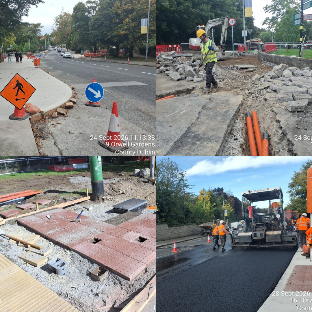
1. Works elements completed / ongoing:
Final surfacing works were completed at the Braemor Park junction. Road crossings are now complete at both the Braemor Park and Dodder Road Lower/Orwell Road junctions. Footpaths and tactile paving works are ongoing at Dodder Road Lower/Orwell Road junction.
2. Works lookahead:
Line marking at Braemor Park junction and commissioning of the traffic signals are scheduled to take place in October and November.
3. Early warning items:
- The Dodder Road Lower is now a permanent one-way system.
- Motorists are advised to plan alternative routes.
4. Other:
- The next update is on Friday, 30th October 2026.
- For weekly traffic news updates, please visit Traffic News | Dún Laoghaire-Rathdown County Council
7th August 2026: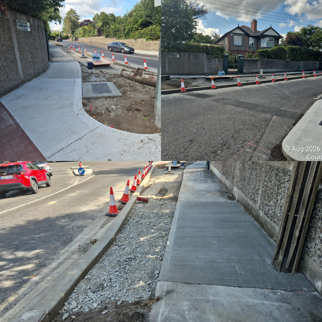
1. Works elements completed / ongoing:
- Work location - southwest corner of Braemor Park/Orwell Road Junction.
- Traffic ducting and chambers have been installed, and the area is to be landscaped.
- Road crossings for traffic ducting to commence tomorrow, 8th August 2026, at this junction.
2. Works lookahead:
- Traffic Management measures will be installed at the Dodder Road Lower / Orwell Road junction.
- The Dodder Road Lower will be fully closed for 7 days, starting on Monday 10th August, after which a permanent one-way system will also be introduced along the Dodder Road Lower.
3. Early warning items:
Once the one-way system is implemented on Dodder Road Lower, vehicles will no longer be able to access the road from Orwell Road. Motorists are advised to plan alternative routes.
4. Other:
- The next update is on Friday, 21st August 2026.
- For weekly traffic news updates, please visit https://www.dlrcoco.ie/traffic-management/traffic-news
17th July 2026:
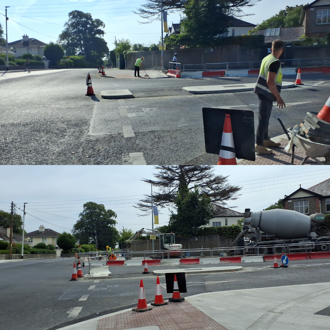
1. Works elements completed / ongoing:
- Works at Braemor Park Junction remain ongoing.
- Footpaths and tactile paving have been installed.
- Road crossings to be completed in early August.
2. Works lookahead:
- Traffic Management measures will be installed at the Dodder Road Lower / Orwell Road junction.
- The Dodder Road Lower will be fully closed for 7 days, starting on Monday 10th August, after which a permanent one-way system will also be introduced along the Dodder Road Lower.
3. Early warning items:
Once the one-way system is implemented on Dodder Road Lower, vehicles will no longer be able to access the road from Orwell Road. Motorists are advised to plan alternative routes in advance.
4. Other:
- For weekly traffic news updates, please visit, Traffic News | Dún Laoghaire-Rathdown County Council
26th June 2026: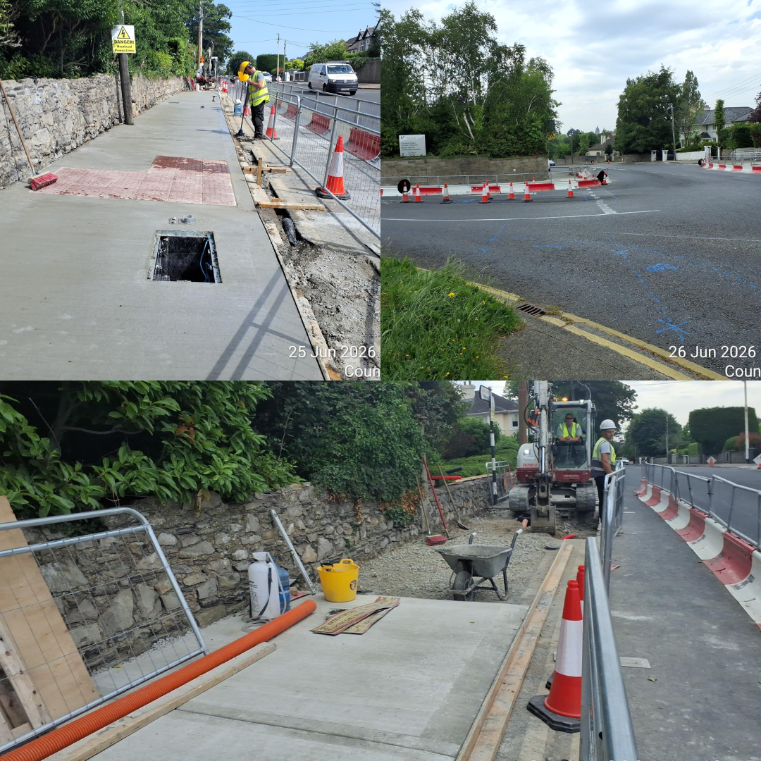
1. Works elements completed / ongoing:
- Works at Braemor Park Junction remain ongoing.
- Initial sections of footpaths and tactile paving have been installed.
- Utility ducting and drainage works are progressing on schedule.
2. Works lookahead:
- Traffic Management measures will be installed at the Dodder Road Lower / Orwell Road junction.
- A permanent one-way system will also be introduced along Dodder Road Lower, date to be confirmed.
3. Early warning items:
- Once the one-way system is implemented on Dodder Road Lower, vehicles will no longer be able to access the road from Orwell Road.
Motorists are advised to plan alternative routes in advance.
4. Other:
- The next update is on Friday, 17th July 2026.
- For weekly traffic news updates, please visit Traffic News | Dún Laoghaire-Rathdown County Council
18th June 2026:
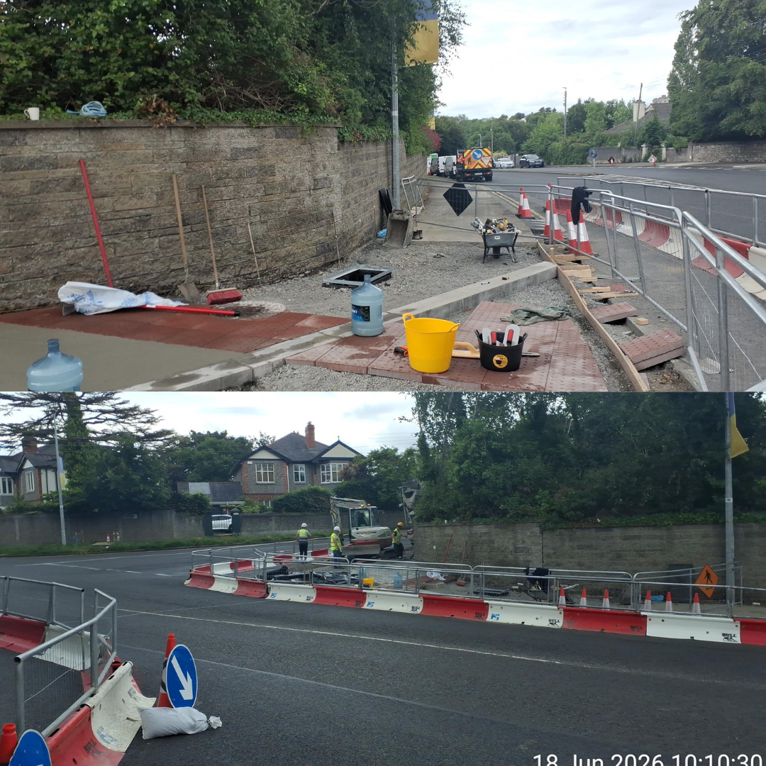
1. Works elements completed / ongoing:
- Works at Braemor Park Junction remain ongoing.
- Initial sections of footpaths and tactile paving have been installed.
- Utility ducting and drainage works are continuing to progress on schedule.
2. Works lookahead:
- Traffic Management measures will be installed at the Dodder Road Lower / Orwell Road junction.
- A permanent one-way system will also be introduced along Dodder Road Lower. Date to be confirmed.
3. Early warning items:
- Once the one-way system is implemented on Dodder Road Lower, vehicles will no longer be able to access the road from Orwell Road.
- Motorists are advised to plan alternative routes in advance.
4. Other:
- The next update is on Friday, 26th June 2026.
- For weekly traffic news updates, please visit: Traffic News | Dún Laoghaire-Rathdown County Council
Overview
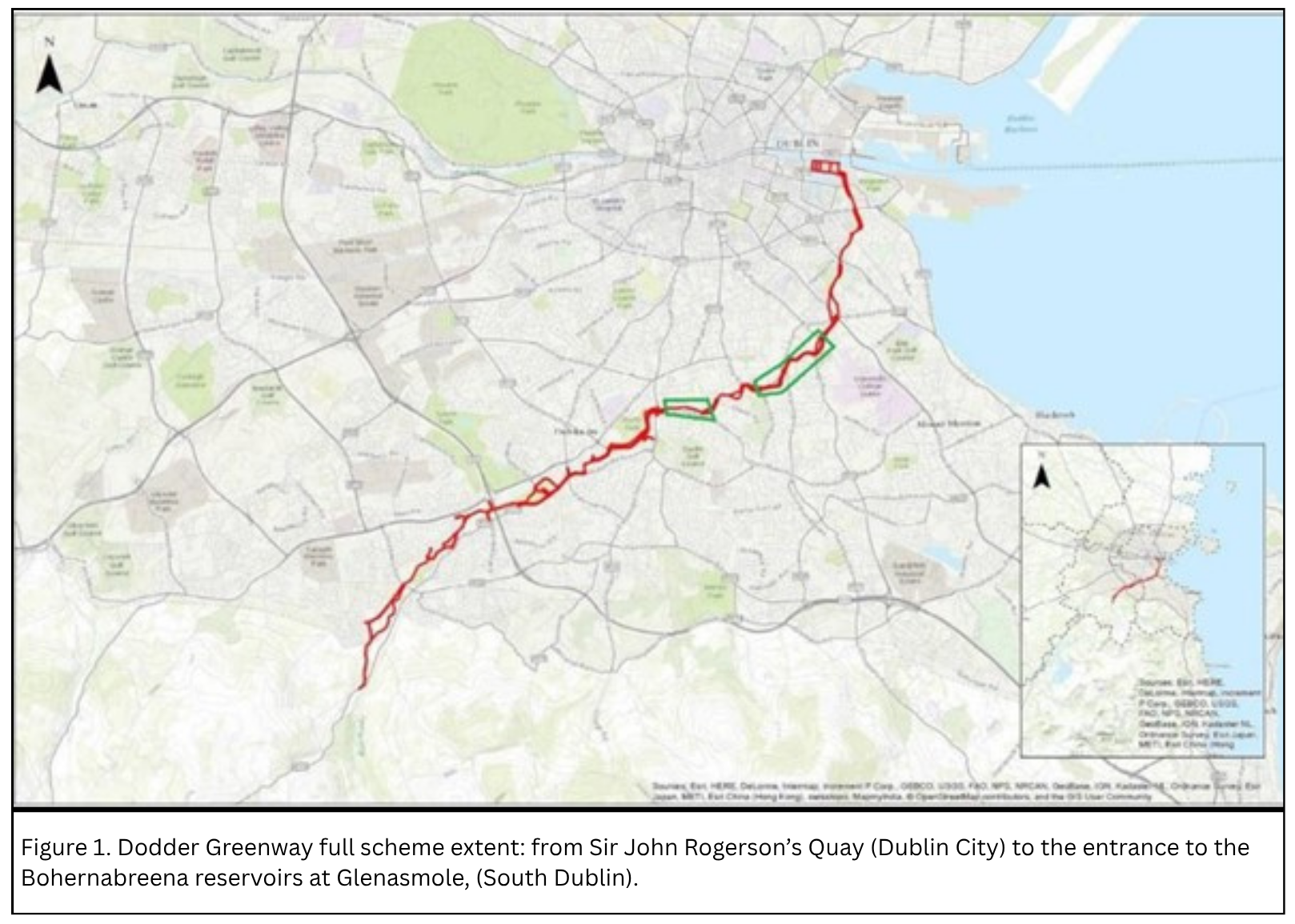
The Dodder Greenway is being developed to be a world-class greenway. It will provide approximately 20km of high-quality walking and cycling facilities along the Dodder River linking Sir John Rogerson’s Quay in the City Centre to the entrance to the Bohernabreena reservoirs at Glenasmole, South Dublin. (See Figure 1 below)
Designed as a blend of off-road and on-road pathways, the greenway will be an inclusive public amenity that enables and encourages more people to walk, wheel and cycle. It will provide access to Ireland’s beautiful linear parkland and offer safe, pedestrian-priority infrastructure.
The Dodder Greenway runs through Dublin City Council, Dún Laoghaire-Rathdown County Council and South Dublin County Council and is being delivered by all three local authorities. It is funded by the National Transport Authority.
The overall scheme's primary objectives are:
To deliver a high-quality, safe and attractive infrastructure for both pedestrians and cyclists, along the linear park.
Provision of linkages within the existing linear park system, particularly along roadways and existing road crossings.
Enhancing the environment, landscape and visual quality of existing parks and paths along the Dodder River.
Enabling modal shift from motorised vehicles.
Boost cycle tourism and attract both overseas and home visitors.
Serve local communities in undertaking daily journeys by walking, cycling or wheeling.
Provide an amenity for all users to encourage physical activity and to contribute to health and well-being.
Overview of the “Dodder Greenway - Ely's Arch to Orwell Road” DLR section:
As part of the Dodder Greenway, Dún Laoghaire-Rathdown County Council, in conjunction with the National Transport Authority, is proposing to develop sustainable transport improvements along the Dodder Road Lower.
The proposed scheme comprises of the provision of a dedicated cycle route together with ancillary pedestrian infrastructure upgrade running along the section of Dodder Road Lower between the junction with Orwell Road and the junction adjacent to the footbridge at the southern entrance to Orwell Park, close to Ely’s Arch (approx. 460m). The last portion of the route, close to Ely’s Arch, falls within the administrative boundary of South Dublin County Council. The scheme also includes the signalisation of the junction between Orwell Road and Braemor Park.
The scheme has been prepared in accordance with Section 38 of the Road Traffic Act 1994.
The scheme has been designed in accordance with national guidance, including the Design Manual for Urban Roads and Streets (DMURS) and the Cycle Design Manual. The scheme is funded by the National Transport Authority (NTA).
Proposed Development:
The scheme proposes to introduce a two-way cycle facility on Dodder Road Lower. This is facilitated by making the Dodder Road Lower one-way.
Alternative route options were considered, including one to retain two-way traffic on the Dodder Road Lower, but this presented several significant environmental and infrastructural challenges (i.e. presence of high-voltage ESB services, the structural conditions of the river wall, removal or pruning of mature trees).
For these reasons, the alternative option was discounted, and the preferred route emerged as the one-way system on the Dodder Road Lower.
The scheme proposals consist of the following:
Removal of the northbound traffic lane along the Dodder Road Lower, retaining the southbound traffic lane.
Provision of a 3.0m wide two-way segregated cycle track along the western side of the Dodder Road Lower.
Widening the existing narrow footpath on the north western side of the Dodder Road Lower, from approx. 1.27m to approx. 2.77m.
- A short stretch of shared pedestrian and cyclist area at the northern end of the Dodder Road Lower will be facilitated to allow access to a new proposed toucan crossing across Orwell Road.
Reconfiguration of the Orwell Road / Dodder Road Lower junction to provide pedestrian and cyclists priority by adding a toucan crossing.
Full signalisation of the Orwell Road / Braemor Park junction.
Addition of a short 2-way cycle track from Orwell Walk to the Orwell Road / Dodder,
Associated ancillary works, i.e. updated road markings, new signage, etc.
A small number of shrubs/trees near the western end of the scheme are to be removed to facilitate footpath widening prior to tie-in with the SDCC scheme.
The scheme extent is approximately 0.87 hectares (ha).
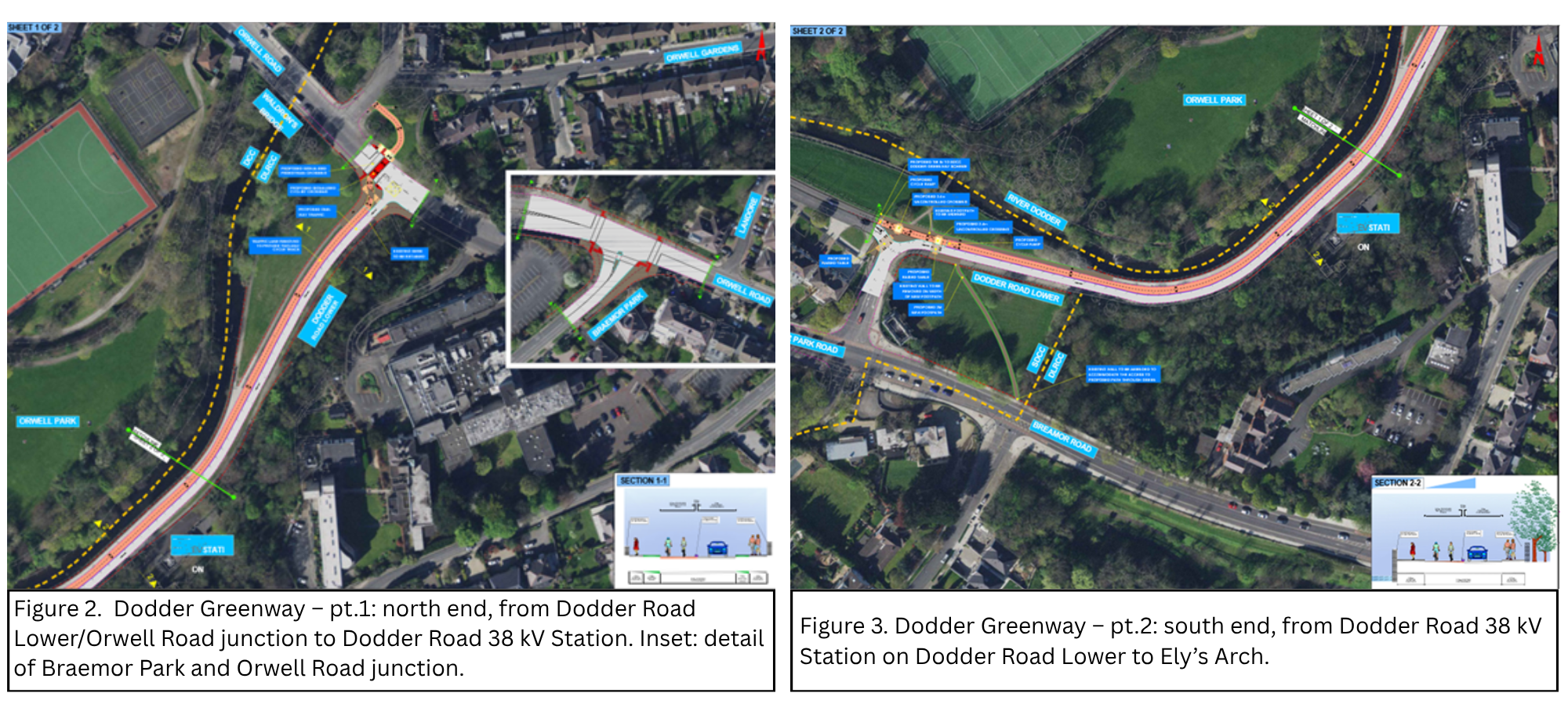
The concept design of the Dodder Greenway - Ely's Arch to Orwell Road” DLR section is shown in Figures 2 and 3 below.
Project Objectives:
Deliver a safe and connected active travel network for people of all ages, genders and abilities by implementing the County Cycle Network and Greater Dublin Area Cycle Network.
Enhance permeability and create a place for all.
Enhance safety for all road users, including vulnerable persons.
Progress the development of the Dodder Greenway project.
Improve connectivity of the Active Travel Network between the Counties of South Dublin and Dún Laoghaire-Rathdown.
Traffic Impacts:
The impact on traffic has been thoroughly evaluated at the Planning and Option development stage, with the transport analysis showing that the impact on traffic flows will be negligible across the nearby network and junctions.
The introduction of traffic signals at the Braemor Park / Orwell Road junction will mitigate and regulate additional flows at Braemor Park as a traffic-calming measure and will also provide safer conditions for pedestrians by introducing new pedestrian crossings at all arms.
The Active Travel section will monitor and assess the overall transport impacts of the scheme after construction.
Conclusions and next steps:
The DLR scheme will provide a significant improvement to pedestrian and cycle permeability, including new infrastructures to enhance safety and journey times for all users, as well as contributing to the development of the overall Dodder Greenway scheme, a fundamental part of a nationwide network of Greenways and therefore achieving Policy objectives at local, regional and national level.
The Construction period is approximately 8 months, as per the programme, and works will start on site in June 2026, with the appointed contractor being Clonmel Enterprises Ltd.