Dún Laoghaire-Rathdown County Council will be making a number of upgrades and improvements to the Dundrum area in the coming months and years. The future of Dundrum has been shaped through a comprehensive planning and public consultation process. The Dundrum Local Area Plan 2023, formally adopted by the elected members of Dún Laoghaire-Rathdown County Council, sets out a long-term vision for Dundrum as a vibrant, inclusive, sustainable and well-connected town. These projects build on that vision, enhancing Dundrum as an attractive place to live, work and visit. They complement projects already in planning, including the DLR Connector scheme, and will help lay the foundations for further improvements to the village in the years ahead.
Benefits will include:
- Improved bus services.
- New landscaping in Dundrum Village.
- New public spaces.
- Formalisation of temporary road layout.
- Accessible urban design.
- Better walking & cycling connections.
- Safer junctions & updated road design.
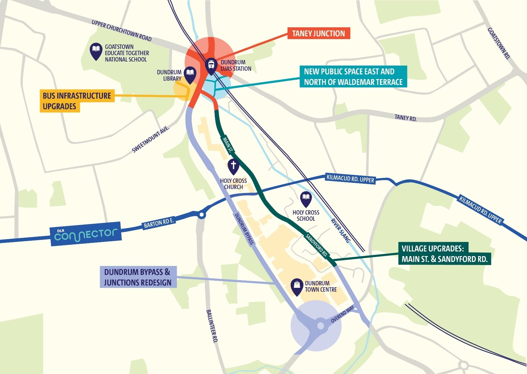
1. Bus Infrastructures Upgrades
Improving bus services and making way for public space.
What?
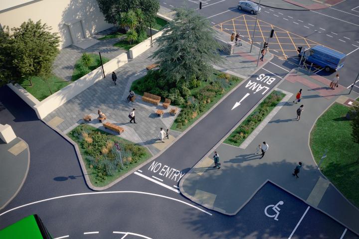
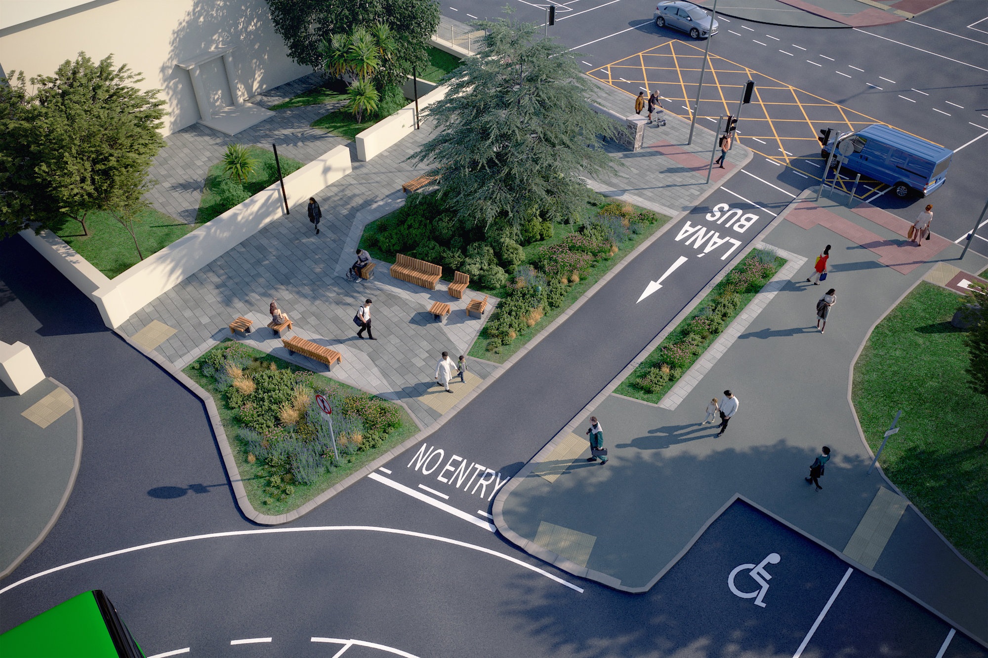
A new one-way, bus-only road is being built to connect Sweetmount Avenue to Main Street. This Bus Gate will improve bus services, and a new bus stop will be added on the Dundrum bypass. There will be no impact on existing bus stops or on car circulation. The existing bus layover spaces on Waldemar Terrace will be redistributed to nearby agreed locations.
When?
Following consultation in 2025, work on this project is due to be completed in 2027.
Frequently Asked Questions (FAQs):
1. Purpose of the Scheme
The scheme is required to facilitate the rollout of the BusConnects network and to enable the future redevelopment and public realm enhancement of Waldemar Terrace.
It is consistent with the objectives of the Dundrum Local Area Plan and broader national and regional sustainable transport policies.
It is in response to requests during the wider Bus Connects Consultation in 2018, where improved bus services and frequencies were requested for Dundrum
2. Why the existing bus layover cannot be retained:
The existing layover facilities at Waldemar Terrace will not be sufficient to accommodate future operational requirements, and their relocation is required to facilitate the public realm improvements envisaged in the Dundrum Local Area Plan 2023.
3. Severance of Connection Between Buses and LUAS
The existing bus-LUAS interchange remains an important transport asset, the relocation of layover facilities from Waldemar Terrace was identified in the Dundrum Local Area Plan 2023 to facilitate future public realm and mobility improvements.
The proposed layover spaces will be used for buses waiting between services and are not proposed as passenger boarding locations at this time.
Bus stops serving passengers will remain closer to the LUAS station and Dundrum Village, on Taney Road, Dundrum Bypass and Dundrum Main Street, maintaining convenient interchange opportunities.
4. Why is the Bus Gate being introduced and why can’t it be moved further south?
The proposed bus gate between Main Street and Sweetmount Avenue is an essential component of the scheme, enabling buses to circulate between the proposed layover locations and Dundrum Main Street and forming part of the vision set out in the adopted Dundrum Local Area Plan 2023.
Relocating the bus gate further south is not feasible, as buses require a specific alignment to safely transition from Dundrum Main Street onto the bus gate and then rejoin Sweetmount Avenue. Moving the bus gate southwards would compromise these necessary vehicle manoeuvres and the safe operation of the route.
5. Impact on Traffic at Churchtown Road Upper/Taney Cross
In response to concerns raised during consultation, design amendments have been made to provide layover facilities off-line on Churchtown Road Upper, retaining more road space for vehicular traffic. This approach is intended to minimise impacts on traffic flow while continuing to provide the layover capacity required to support the future BusConnects Network Redesign.
The left-turn slip lane from Churchtown Road Upper to Dundrum Road at Taney Cross will be retained following design amendments as part of this scheme.
6. St. Nahi's Church – heritage & parking
The Council recognises the significance of St. Nahi's Church and Graveyard and the importance of preserving the area's heritage character. It should be noted that the presence and movement of buses within historic urban environments is a common feature of towns and cities throughout Ireland, including many heritage areas within Dublin City, and forms an important part of a sustainable urban transport network.
The proposal does not remove any formal on-street parking spaces from outside the church. The proposed layover spaces utilise the existing on-road cycle lane, where parking is currently prohibited from Monday to Saturday.
Environmental, heritage and archaeological assessments undertaken did not identify impacts that would prevent the scheme proceeding.
7. Impact on pedestrian and cycling routes between Dundrum and Churchtown including road safety concerns
The scheme has been developed to maintain existing pedestrian and cycle connections between Dundrum and Churchtown. Existing walking and cycling routes will remain available, and improvements are proposed at key locations to support safer and more attractive active travel connections throughout the area.
Road Safety Audits have been undertaken, and further audits will occur through the detailed design and implementation stages.
8. Have alternative options been considered
A range of potential locations were considered during the development of the scheme. The current proposed arrangement was selected as it can accommodate the operational requirements of the future BusConnects Network Redesign within the existing public road corridor.
Given the constrained nature of the area and the requirement for layover facilities to be located close to route termini, the proposed locations represent the most feasible option for providing the necessary infrastructure and layover capacity on lands currently under the control of Dún Laoghaire-Rathdown County Council, while supporting the future operation of the bus network
9. Consultation Influenced the Final Design
Changes made following feedback from the public are as follows:
- Bus layover facilities on Churchtown Road Upper will be provided off-line, largely retaining existing traffic movements.
- Enhanced public realm improvements will be delivered outside the Carnegie Library, including new planting and seating areas.
2. New Public Space East and North of Waldemar Terrace
A new destination and congregation space.
What?
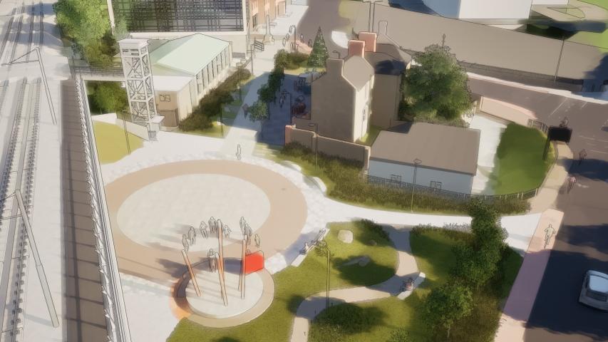
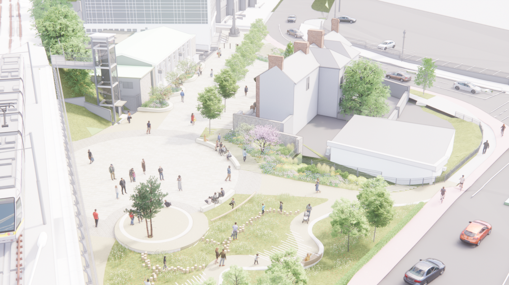
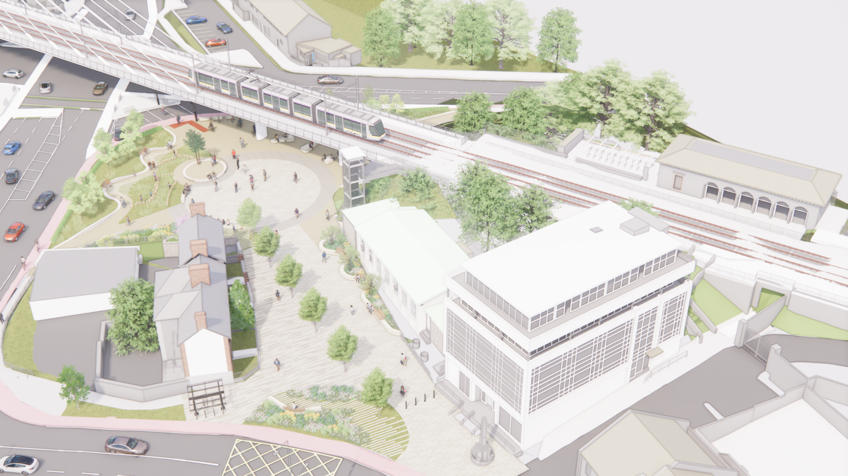
A significant new public realm is planned for the areas east and north of Waldemar Terrace, which serves as a new gateway to Dundrum Village. Rebalancing the village by delivering a a new civic space, including landscaping, planting, seating and natural play. This project will assist the delivery of the objectives of the current Local Area Plan by enhancing Dundrum's Public Realm, supporting sustainable mobility and creating a more vibrant town. The scheme has also secured grant funding of up to €4 million from Urban Regeneration Development Fund (URDF - Call 2).
When?
Designs are currently being developed and will be presented as part of a statutory Part 8 public consultation process, anticipated to commence at the end of November 2026.
Works on site will commence once the Bus Infrastructure works are complete.
Why?
This will become a new destination and public space, welcoming people into the town and consolidating Dundrum as a place to visit, meet and gather.
What Happens Next?
To minimise disruption and ensure timely public engagement, these projects will be delivered sequentially rather than all at once.
Each project will have its own separate planning and consultation process. As individual projects progress, more detailed information and design proposals will be available, and the public will be invited to share their feedback during consultation windows.
Together, these projects will help deliver the long-term vision laid out in the Local Area Plan and ensure that Dundrum continues to be a vibrant, inclusive, sustainable and attractive place to live, work and visit.
Gallery